Although Stonewall and the RM of Rockwood were badly hit with overland flooding that damaged homes and businesses and washed out roads on the night of June 9–10, communities in the eastern half of the Interlake dodged the worst of the storm.
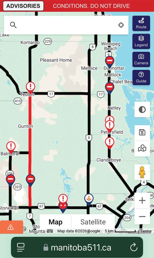
The storm washed out, flooded and closed portions of east Interlake highways including HIghway 9 and Highway 17 (gravel portion). On the west side, HIghway 7 was impassable between Stonewall and Teulon
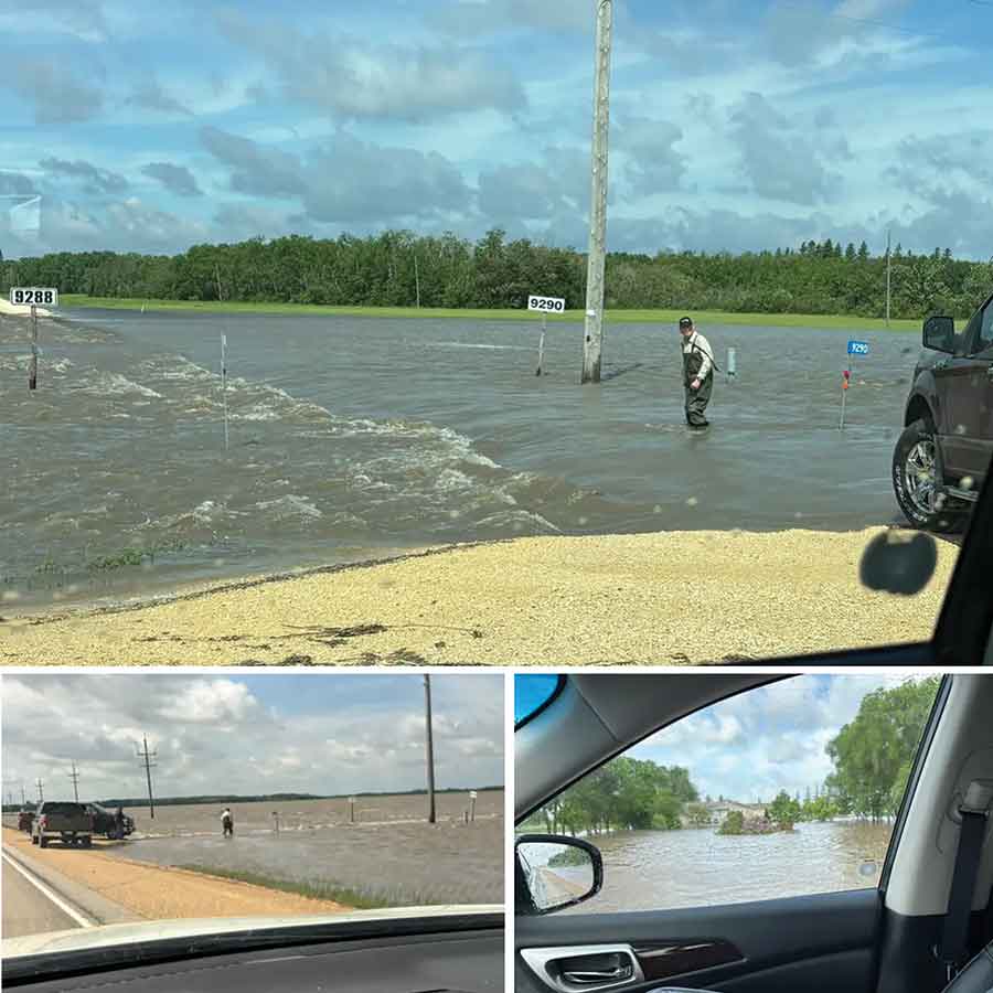
People posted photos of overland flooding in the east part of the Interlake after the storm of June 9-10
An unstable weather system moved north into the Red River Valley from the U.S., unleashing torrential downpours, high winds, hail and tornadoes that were confirmed in southern Manitoba, including near Ste. Anne and Dufrost.
Although the east Interlake was left, overall, relatively unscathed, some communities such as Winnipeg Beach and Dunnottar were impacted by overland flooding that inundated properties, washed out roads and closed Highway 9 in at least three locations, including a long stretch between Highway 17 and PR 225. Highway 17 itself (the gravel portion) between highways 8 and 9 was closed.
Municipal emergency coordinator Don Emes, who oversees the RM of Gimli, the RM of Armstrong and the Town of Winnipeg Beach, said he sympathizes with the people who are suffering in Stonewall. They “took the hit” in the Interlake because of the way the storm tracked.
But there were no major consequences as a result of the storm in Gimli and Armstrong.
“In Armstrong there was lots of capacity in the marshes to soak up and hold water. And there have been improvements done on some of the drains over the past years, so the water is moving as it should,” said Emes last Thursday. “This was a bad situation and it was widespread in locations. There were hotspots here and hotspots there, but everybody got water.”
Winnipeg Beach and Dunnottar, on the other hand, experienced some flooding and infrastructure damages.
“Winnipeg Beach lost a lift station and they have some issues with their lagoon. But they’re working on it,” said Emes. “And Dunnottar had some flooding.”
Emes said all that water will now have to make its way along its normal course eastwards through drains and ditches and empty into Lake Winnipeg.
RM of Armstrong CAO Colleen Mayer confirmed the municipality was not greatly impacted by the storm.
“We did have one road (15E between 103 and 104) that was affected with some water running over it, but that has been addressed by our public works department,” said Mayer. “We will continue to monitor all roads and conditions as more rain is expected.”
Gimli had water flowing over roads and some plunged culverts, but the impacts from the storm were minor.
“The RM of Gimli experienced only minor impacts from the recent weather,” said RM spokesperson Christine Payne last Friday. “There were a few instances of water flowing over roads, but no washouts were reported. Some culverts were temporarily plugged by debris, and there were a couple of trees downed along with minor branch damage due to wind. Overall, impacts were limited and manageable.”
Winnipeg Beach CAO Jodi Mitchell said last Friday the town will have to repair washouts on roads and driveways and repair lift-station pumps. In terms of the number of residents and businesses affected by the flooding, the town doesn’t yet have an estimate as residents and business owners have been assessing their own properties.
At least six driveways are “completely impassable.”
In a June 11 notice on its website, the town said the lagoon took on a significant volume of water and is currently operating at the higher end of its normal operating range, but levels remain “acceptable at this time.”
Mitchell said they could request from the province an emergency release.
“We are a few days away from our regularly scheduled release. However, if it appears to be more emergent, we will request an emergency release,” said Mitchell.
She added that they’re continuing to monitor the lagoon and work on repairs to the lift station pump.
“Pump trucks are no longer needed at this point as one pump is back operating and handling water volumes,” she said. “We will continue to monitor the situation. Residents have been advised to take pictures and keep an inventory for insurance purposes.”
The Village of Dunnottar, which is made up of the communities of Matlock, Whytewold and Ponemah, experienced heavy rainfall during the event last Tuesday.
CAO Sarah Palson said the rain hit all three communities, but Matlock was the most severely affected.
“Many properties and roadways were under anywhere from 6 to 18 inches of water. As the Village is the last drainage for all water coming from the west, the water was coming in so quickly and in such large volumes, we were very limited in where we could set up pumps and where we could pump the water to have an effect,” said Palson on June 11. “We have been able to set up pumps today, however there is still a significant amount of water crossing over Highway 9 and entering … the Village. We are actively working to mitigate the effects of the incoming water to our residents.”
Residents whose properties were flooding sent concerns to the village office starting at about 3:30 a.m. on Wednesday morning, she said. Some property owners had water entering their crawlspaces.
Although major routes were closed, the provincial government stepped in quickly to help Dunnottar.
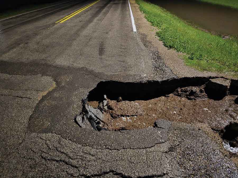
“A section of Gimli Road, between Whytewold Road and Matlock, was closed for a portion of Wednesday throughout the day due to a washed-out section of this highway. Thanks to the quick action taken by the Province of Manitoba, they were able to perform a temporary fix and allow traffic to access the roadway once again,” said Palson. “Due to overland flooding and additional traffic on alternate routes, we did need to close another road within the municipality to ensure the integrity of the road was not compromised.”
Palson said the regional coordinator of the provincial Emergency Measures Organization came to the administration office to “check in and offer supports as needed.”
“We are hopeful that the province will announce a Disaster Financial Assistance program in response to this weather event,” said Palson.
Premier Wab Kinew did, in fact, announce province-wide disaster financial assistance for flood damages later that Thursday as he toured Stonewall and Balmoral.
Stonewall received an unprecedented 255 millimetres of rain, and Highway 7 between Stonewall and Teulon was closed.
The storm caused sewage discharges into the Assiniboine and Red rivers in Winnipeg from pumping stations in Winnipeg, as well as discharges from Winnipeg’s combined sewer overflows (CSOs).
A spokesperson for the City of Winnipeg told the Express it’s unknown how much raw sewage entered the two rivers from CSOs.
“We do not have volume data to report on CSOs as they happen,” said communications coordinator Lisa Marquardson last Friday. “We only post our CSO volumes annually.”
Combined sewers are shown on a map provided by the city. It notes when an overflow is happening, when it started and when it ended. But the information from the June 9-10 storm is no longer available on the map as “too much time has passed,” she added.
Raw sewage discharges from city pumping stations are available as the city is mandated to report them on its Reports on Untreated Sewage webpage.
It shows about 8.72 million litres of sewage entered the river system between June 9 and 10. The discharges were caused by hours-long power failures.
All that sewage flows north into Lake Winnipeg.